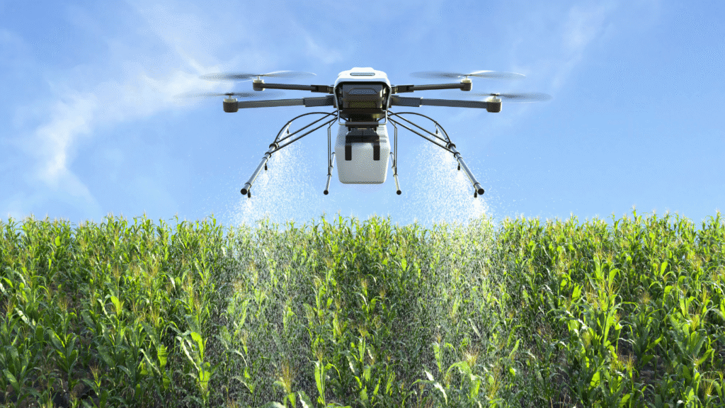
Leverage FAA-certified drone teams + our SeraPoint® 3D platform for inspections, mapping, and workforce training in industries like energy, agriculture, and infrastructure.
Halkin Inc. was founded in 1982 to perform non-destructive testing and infrastructure installation services for a variety of industries. At the turn of the millennium, Halkin Inc. sold most of its divisions to large, multi-national inspection and non-destructive testing entities. Halkin has shifted its focus and resources to drone-based, asset management, materials inspection, agricultural analysis, mapping services, curriculum development, and workforce training. From materials inspection to scale rendered mapping and land analysis, Halkin’s certified technicians and software engineers provide customers with concise and expedient reporting and training through a conjunct GIS software platform.
What We Do
Halkin’s certified pilots and inspectors use drone and GIS technology to conduct a variety of materials inspection, create As-Built drawings and administer land parcel mapping through advanced automated drone flight programming and virtual, GIS reporting. Halkin’s software engineers developed and deployed SeraPoint, a virtual, highly collaborative GIS platform initiated by advanced, automated drone flights. Our certified instructors provide drone educational course development and workforce training programs for private and public organizations and secondary / post secondary schools.
Halkin Inc. has completed several geospatial and GIS projects in the United States and internationally. In the U.S., our work includes 4-lane road widening projects across multiple counties in California, LiDAR-based road safety assessments for various states, and numerous GIS mapping initiatives. Internationally, we have delivered extensive photogrammetry and cartography projects in Texas. These include compilation mapping for multiple areas. Projects were completed at various scales, including 1:1,000, 1:2,500, and 1:10,000. Halkin Inc. also brings deep expertise in GIS, including data editing, spatial analysis, and 3D fly-throughs using tools like ArcGIS and QGIS. Our team handles a variety of geographic data types—vector (points, lines, polygons), raster (imagery), and tabular data. We create detailed, informative maps for applications in environmental science, urban planning, transportation, and more. Our GIS professionals have served in roles such as GIS Technician, Analyst, and Specialist, ensuring flexible, industry-specific
solutions.
Halkin Inc. was contracted to perform comprehensive inspections on the Hajj Terminal in Jeddah, Saudi Arabia. The primary task involved electromagnetic testing of all the wire rope supporting the terminal’s structure. These cables are critical to the terminal’s stability, so great care was taken to ensure a thorough and accurate assessment. Using a Magnograph unit, Halkin conducted internal inspections to detect damage not visible through
standard visual methods. All wire ropes were certified to be in satisfactory condition at the time of inspection. In addition, Halkin performed x-ray inspections of critical welds and steel connections throughout the terminal. This process identified any internal anomalies such as cracks, porosity, or other structural defects. The results confirmed the steel and welds were in good condition, with no repairs required. Visual inspections were also carried out
on all fabric (canvas) structures to identify any degradation, separation, or tearing. Minor issues were found and promptly repaired. Halkin successfully completed and certified all inspections, providing the Saudi government with the necessary assurances to continue safe terminal operations.
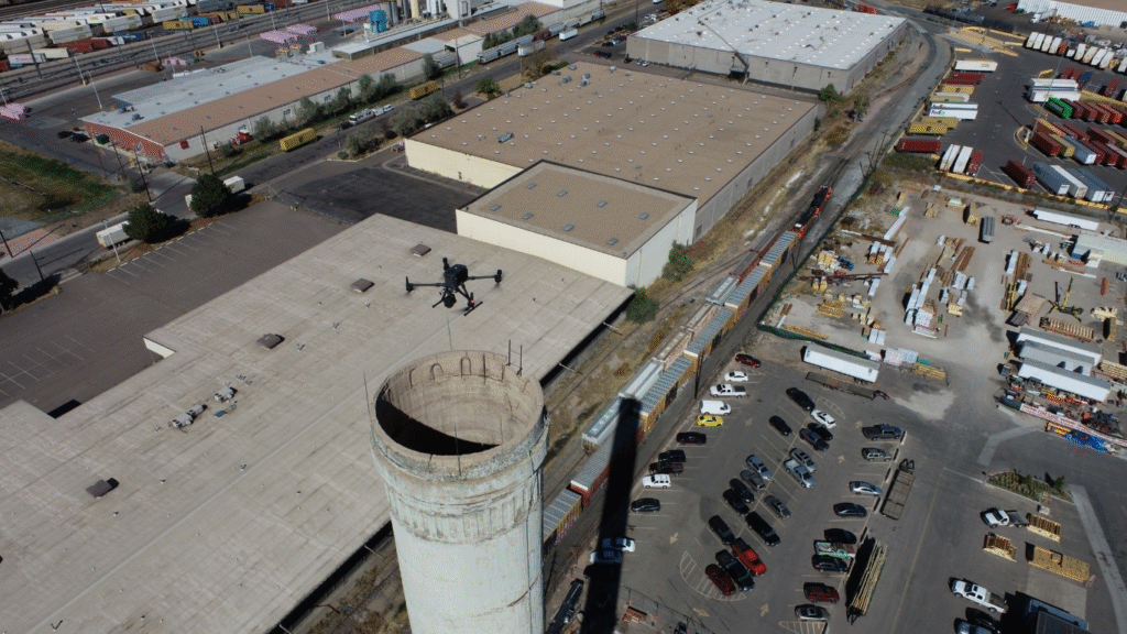
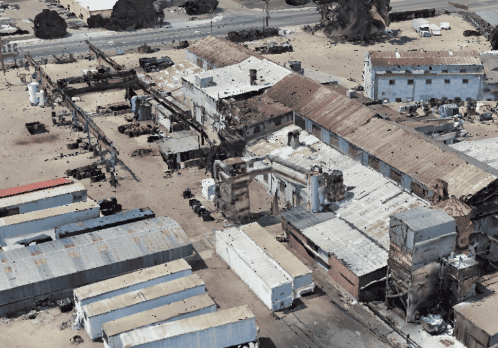
Halkin Inc. conducted a full-scale drone survey and inspection for the Western Foundry Factory to support site planning, operational monitoring, and safety assessment. Using high-resolution aerial imaging, 3D mapping, and advanced data capture, our team delivered precise visuals and actionable insights that traditional ground inspections cannot achieve.
The drone operation provided a complete overview of the factory layout, identified structural and equipment-level issues, and helped streamline workflow planning. With fast data collection, improved accuracy, and zero disruption to factory operations, Halkin Inc. enabled Western Foundry to enhance efficiency, strengthen maintenance planning, and make informed decisions backed by reliable aerial intelligence.
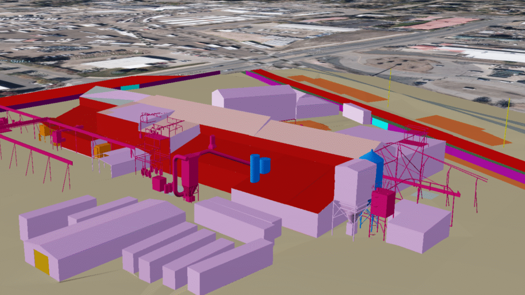
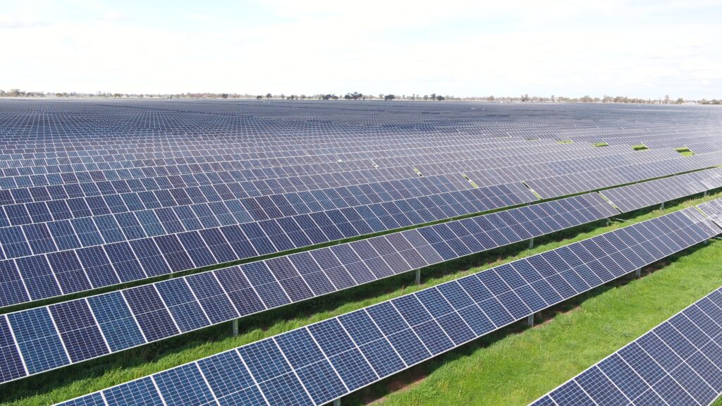
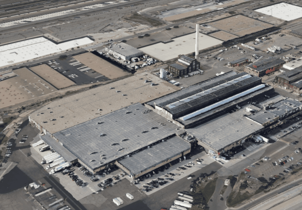
Halkin Inc executed a dedicated Photogrammetry Project using advanced drone technology to capture high-resolution aerial imagery and transform it into accurate 2D maps and 3D models. Through precise image acquisition and AI-enhanced data processing, we generated detailed spatial representations of the project area, enabling improved planning, measurement, and analysis.
The results provided clients with a reliable digital twin of the site—supporting applications such as land surveying, construction progress tracking, volumetric calculations, and infrastructure assessment. This project showcases our commitment to delivering fast, accurate, and cost-effective geospatial data using cutting-edge photogrammetry techniques.
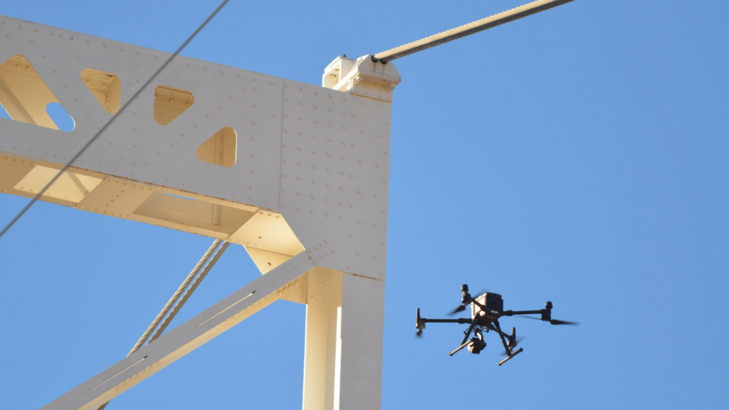
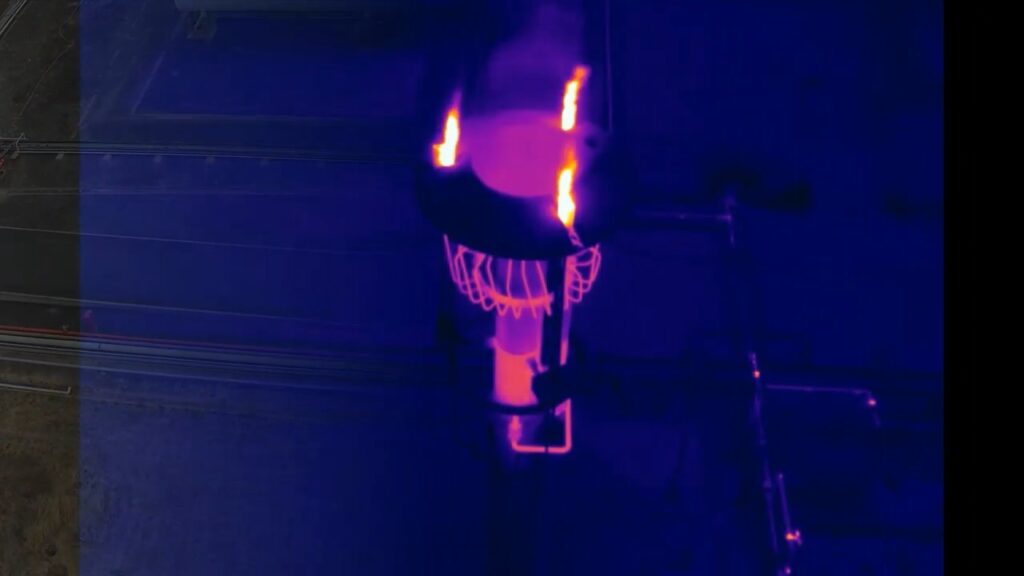
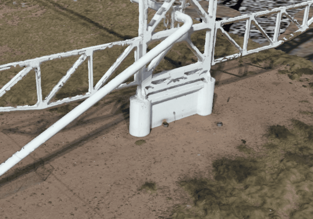
Halkin Inc conducted a comprehensive drone inspection of the Pecos River Oil Bridge to ensure the safety, reliability, and efficiency of this critical energy infrastructure. Using advanced aerial imaging, thermal sensors, and high-precision data capture, our team assessed the structural condition of the bridge without disrupting ongoing operations.
The inspection provided detailed visuals of hard-to-reach components, identified early signs of wear or corrosion, and delivered accurate insights to support maintenance planning and risk mitigation. By leveraging drone technology, Halkin Inc enabled faster, safer, and more cost-effective inspection compared to traditional methods — ensuring Kinder Morgan can maintain uninterrupted and secure oil transport operations.
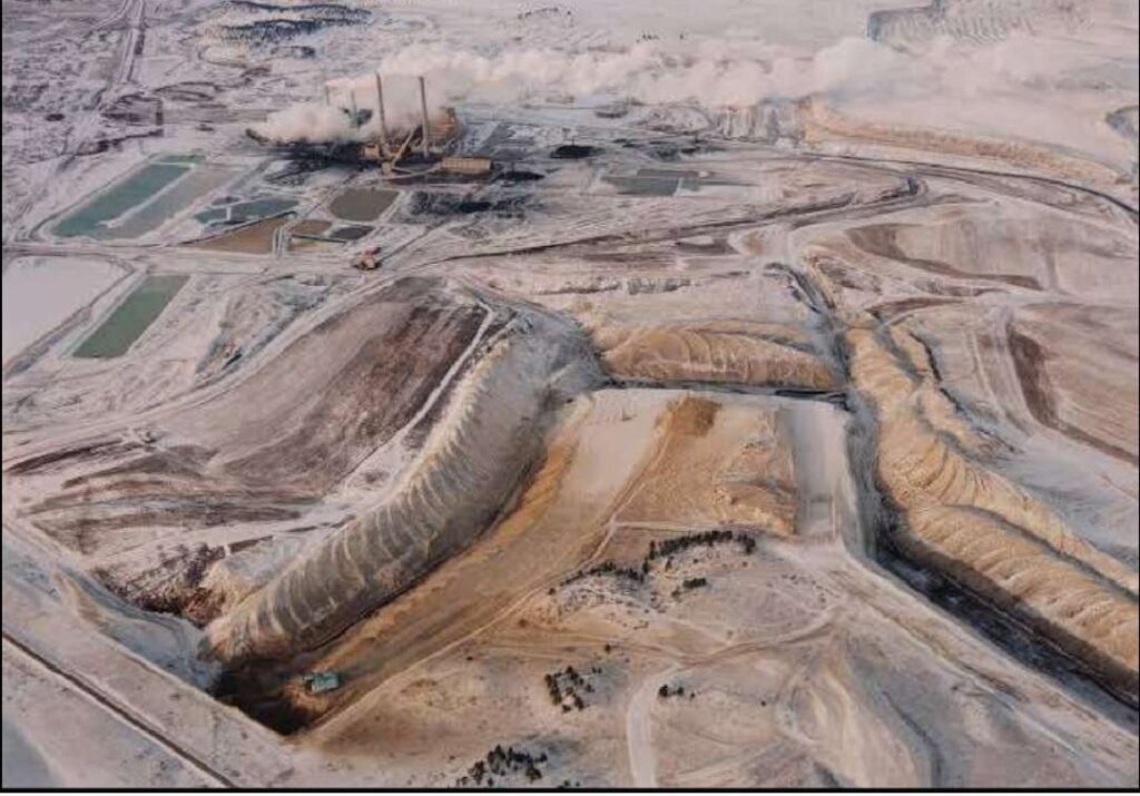
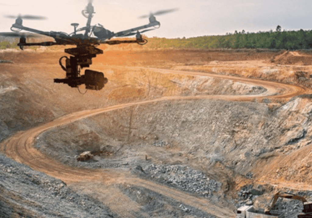
Halkin Inc successfully delivered a comprehensive drone survey and inspection project for a major mining operation in the United States. Using advanced UAV technology, we captured high-resolution aerial imagery, detailed topographic data, and precise volumetric measurements across the site.
Our drone-based approach provided mining engineers and site managers with accurate insights into terrain conditions, stockpile volumes, excavation progress, and operational safety. By replacing traditional manual surveying with high-efficiency drone workflows, we significantly reduced on-site risk, improved data accuracy, and accelerated reporting timelines.
This project highlights Halkin Inc’s capability to support large-scale mining operations with reliable photogrammetry, GIS mapping, Lidar data processing, and actionable analytics—helping clients optimise productivity while maintaining the highest safety standards.
The inspection provided detailed visuals of hard-to-reach components, identified early signs of wear or corrosion, and delivered accurate insights to support maintenance planning and risk mitigation. By leveraging drone technology, Halkin Inc enabled faster, safer, and more cost-effective inspection compared to traditional methods — ensuring Kinder Morgan can maintain uninterrupted and secure oil transport operations.
We are here to serve you
From materials inspection to scale rendered mapping and land analysis, Halkin’s certified technicians and software engineers provide customers with concise and expedient reporting and training through a conjunct GIS software platform.